
Lake Amboseli Kenya: Complete Guide to the Dry Salt Pan
Overview
Lake Amboseli is a wide, seasonal soda lake sitting in the western sector of the park. About 10,000 years ago during the Pleistocene epoch, it wasn’t a salt pan—it was a deep freshwater inland sea reaching over 40 meters down. Today, it operates mostly as a dry pan made of mineral-rich soda soils. Managed by the Kenya Wildlife Service (KWS) right under Mount Kilimanjaro, the dry floor shifts during heavy rains into a shallow water basin that draws in thousands of flamingos.
Fast Navigation Links
- Pleistocene Origins & Water Flows
- Surviving Midday: Mud, Dust & Mirages
- Conch Lake & Mining History
- Safari Package Rates & Itineraries
- Frequently Asked Questions
Blinding white glare and relentless, salty dust greet you the moment you pull onto Lake Amboseli around noon. Hot afternoon winds whip fine alkali silt through every unsealed window in your 4×4, coating teeth, dashboard dials, and camera lenses within minutes.
Most drivers bypass the dry pan entirely during the heat of the day, heading straight for the shaded marshes described in our Amboseli National Park guide. Yet this sun-baked expanse is what keeps the surrounding ecosystem alive. Underground meltwater from Mount Kilimanjaro seeps beneath the basin floor, feeding permanent marsh pockets that sustain wildlife long after surface rains evaporate.
Pleistocene Origins & Present Hydrology
Most of the year, Lake Amboseli isn’t a lake at all—it’s a blinding, dust-choked salt pan where you can drive for miles across baked earth without seeing a drop of standing water.
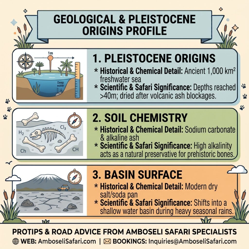
Ten thousand years ago during the Pleistocene epoch, things looked completely different. Core soil samples taken across the basin prove an ancient freshwater sea stretched over 1,000 square kilometers here, reaching depths of more than 40 meters. When volcanic eruptions from Mount Kilimanjaro altered regional drainage channels, the water evaporated, leaving behind a thick crust of sodium carbonate, alkaline salt, and ash.
That extreme soil alkalinity comes with a practical scientific benefit. Research logs from the Amboseli Elephant Research Project note that the salty silt acts as a natural preservative, keeping prehistoric animal bones and ancient elephant skeletons buried here intact for thousands of years without decaying. Visitors driving near these fossil beds must strictly obey rules of Amboseli National Park to prevent vehicle damage to unexcavated sites.
Geological & Pleistocene Origins Profile
Long before operating as a dry soda pan, Lake Amboseli existed as a massive freshwater sea covering over 1,000 square kilometers during the Pleistocene epoch. Volcanic activity and regional climatic shifts transformed the basin into the mineral-rich salt pan seen today. The geological profile below highlights the ancient origins and unique preservation properties of the basin’s alkaline silt.
| Geological Aspect | Historical & Chemical Detail | Scientific & Safari Significance |
| Pleistocene Origins | Ancient 1,000 km² freshwater sea | Depths reached >40m; dried after volcanic ash blockages. |
| Soil Chemistry | Sodium carbonate & alkaline ash | High alkalinity acts as a natural preservative for prehistoric bones. |
| Basin Surface | Modern dry salt/soda pan | Shifts into a shallow water basin during heavy seasonal rains. |
Surviving Midday on the Lakebed: Mud Traps, Dust Devils & Mirages
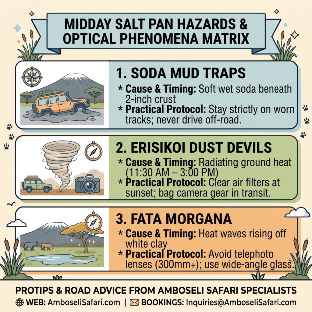
The baked clay pan looks like a wide, open highway, but leaving marked tracks is an easy way to ruin a trip. Underneath a thin, two-inch crust of sun-baked salt sits a layer of soft, wet soda mud. We once watched a Land Cruiser slip just two meters off the marked track near Conch Lake; four hours later, we had burned through two recovery ropes trying to yank it out of the grey soda mud. Stick strictly to worn wheel ruts, never cutting new paths across smooth clay patches. Drivers planning independent trips should review our Amboseli self-drive tips and verify live Amboseli road conditions before venturing onto the pan.
Local Maasai call the towering whirlwinds that sweep across the pan Erisikoi. Building rapidly between 11:30 AM and 3:00 PM as ground heat radiates off the white clay, these dust devils whip up fine alkali silt. Amboseli’s fine alkali dust acts like microscopic glass in an engine bay—pop your air filter boxes at sunset to clear the silt before morning. A single whirlwind can also coat camera sensors in microscopic grit if a vehicle window is left open, making protective bags vital when carrying safari camera gear across the basin.
Between noon and 2:30 PM, intense heat rising off the pan collides with cooler air above it, creating strange Fata Morgana mirages where distant zebra herds appear to float completely off the ground and solitary yellow-fever trees (Acacia xanthophloeia) look like they are standing in deep water. Photographers attempting to capture these mirages should swap out 300mm or 500mm telephoto lenses because long glass magnifies heat waves into blurry smears. Switching to a wide-angle lens captures the wide horizon without heat distortion, a technique detailed in our Amboseli wildlife photography guide alongside seasonal timing tips from our best time to visit Amboseli planner.
Midday Salt Pan Hazards & Optical Phenomena Matrix
Crossing the wide, open expanse of Lake Amboseli presents unique driving and technical photography challenges caused by intense ground radiation. Hidden mud pockets, airborne alkali dust, and intense heat distortion can easily impair vehicles and camera gear. Review the hazard matrix below for tactical advice on navigating the salt pan safely.
| Hazard / Phenomenon | Cause & Timing | Practical Driver / Photographer Protocol |
| Soda Mud Traps | Soft wet soda beneath 2-inch crust | Stay strictly on worn tracks; never drive off-road. |
| Erisikoi Dust Devils | Radiating ground heat (11:30 AM–3:00 PM) | Clear air filters at sunset; bag camera gear in transit. |
| Fata Morgana | Heat waves rising off white clay | Avoid telephoto lenses (300mm+); use wide-angle glass. |
Conch Lake & Ephemeral Flamingo Migrations
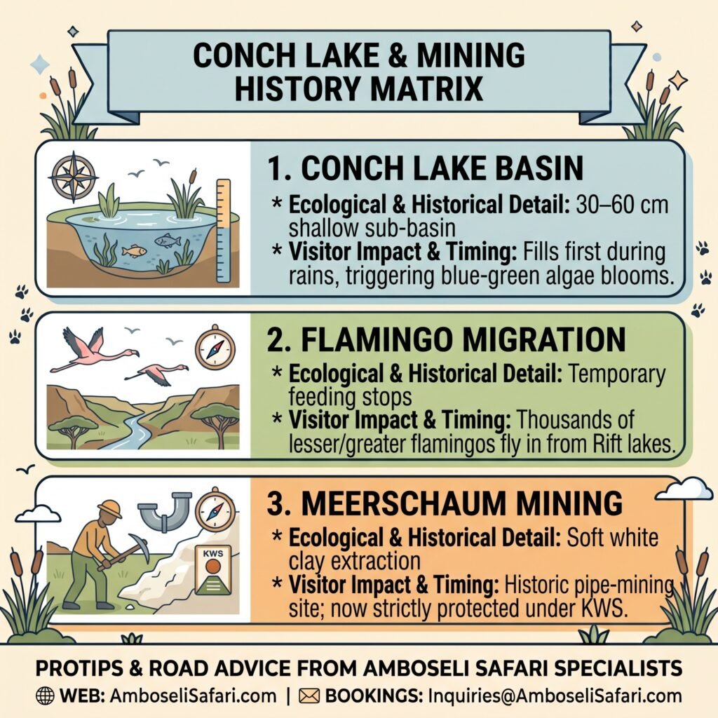
Tucked along the eastern edge of the main dry basin lies Conch Lake, a small sub-basin that behaves completely differently from the rest of the pan. When heavy rains hit, Conch Lake fills first, holding shallow water between 30 and 60 centimeters deep. That warm, shallow brine triggers an immediate bloom of microscopic blue-green algae.
Within days, thousands of lesser and greater flamingos fly in from rift valley lakes like Magadi and Natron to feast on the algae, staying for a few weeks before migrating onward as soon as the shallow water dries up. You can track these seasonal waterbird movements on our Amboseli weather by month guide or check species lists in our Amboseli bird watching guide.
Long before Amboseli became a strictly protected national park, the southwestern edge of the lake basin hid deposits of meerschaum—a soft, heat-resistant white clay. Miners extracted this mineral by hand to manufacture tobacco pipes for export to Europe until commercial operations by the Tanganyika Meerschaum Corporation were halted by conservation laws. To read more about how land protections evolved across Kajiado and the neighboring Narok County Council border, see our complete History of Amboseli National Park.
Conch Lake Sub-Basin & Mining History Checklist
Nestled along the eastern boundary of the main dry pan, Conch Lake serves as a vital ecological sub-basin during the rainy months. Rapid algae growth turns these shallow waters into an ephemeral sanctuary for thousands of migrating rift valley waterbirds. The checklist below summarizes Conch Lake’s seasonal wildlife events and historical mineral extraction past.
| Aspect / Feature | Ecological & Historical Detail | Visitor Impact & Timing |
| Conch Lake Basin | 30–60 cm shallow sub-basin | Fills first during rains, triggering blue-green algae blooms. |
| Flamingo Migration | Temporary feeding stops | Thousands of lesser/greater flamingos fly in from Rift lakes. |
| Meerschaum Mining | Soft white clay extraction | Historic pipe-mining site; now strictly protected under KWS |
How to Visit Lake Amboseli: Safari Package Rates & Itineraries
Exploring the dry lakebed, tracking flamingo migrations, and navigating the Enkongo Narok swamp tracks is best done with a private 4×4 setup and an experienced driver who knows where the mud traps hide.
On Amboselisafari.com, our private itineraries combine transport, driver-guide services, accommodation, and park entry permits ($90 USD per 24 hours for non-resident adults) into a single price. Rates are calculated for two adults sharing a private 4×4 Safari Land Cruiser with a pop-up roof. Transport, fuel, and guide fees cost USD 190 per person sharing per day during normal season and USD 400 per person sharing per day during peak dry season (July to October).
We recommend a 4-day itinerary pairing Amboseli with Tsavo West National Park.
4-Day Amboseli & Tsavo West Safari Packages
Prices are total per person based on two adults sharing accommodation and a private 4×4 Land Cruiser.
| Season & Tier | Included Lodges | Price Per Person (USD) | Reserve Your Spot |
| Normal – Budget | AA Lodge Amboseli & Rhino Valley Lodge | USD 1,370 | Book Now |
| Normal – Mid-Range | Ol Tukai Lodge & Kilaguni Serena Lodge | USD 1,610 | Book Now |
| Normal – Luxury | Tortilis Camp & Severin Safari Camp | USD 2,150 | Book Now |
| Normal – Luxury Plus | Angama Amboseli & Finch Hattons | USD 3,560 | Book Now |
| Peak – Budget | AA Lodge Amboseli & Rhino Valley Lodge | USD 2,300 | Book Now |
| Peak – Mid-Range | Ol Tukai Lodge & Kilaguni Serena Lodge | USD 2,600 | Book Now |
| Peak – Luxury | Tortilis Camp & Severin Safari Camp | USD 3,250 | Book Now |
| Peak – Luxury Plus | Angama Amboseli & Finch Hattons | USD 5,050 | Book Now |
You can request a custom safari quote today to design a private trip tailored around your travel dates.
Package Inclusions:
- Private 4×4 Safari Land Cruiser with pop-up roof for game drives.
- Services of a TRA-licensed, English-speaking driver-guide.
- All KWS park entry and vehicle fees for Amboseli and Tsavo West.
- Full board accommodation (breakfast, lunch, dinner) at listed lodges.
- Unlimited bottled drinking water in the vehicle.
- Emergency medical evacuation insurance cover.
Package Exclusions:
- International flights and Kenyan electronic Travel Authorization (eTA) fees.
- Driver-guide tips, alcoholic drinks, and personal laundry.
- Optional activities such as hot air balloon safaris.
Optional Add-Ons:
- Maasai Cultural Village Visit: USD 30 per person.
- Amboseli Hot Air Balloon Safari: USD 450 per person.
- One-Way Flight Upgrade (Wilson Airport to Amboseli Airstrip): USD 540 per person (Includes base airline ticket, rate protection cushion, and operator service fee).
Pairing early morning salt-pan drives with afternoon swamp circuits gives you a wide variety of scenery and wildlife in a short trip. Lodging choices are indexed in our guide on where to stay in Amboseli National Park, while full trip budgeting details are available on our Amboseli safari cost breakdown page. Gate entry logistics are covered under our route breakdowns for Meshanani Gate and Kimana Gate.
Frequently Asked Questions
Is there water in Lake Amboseli year-round?
No. Lake Amboseli is a dry salt pan for most of the year. Water only collects during heavy rain seasons (March to May and November to December), forming a shallow lake that evaporates within weeks.
Can you drive on Lake Amboseli?
Yes, but only along established, marked wheel tracks during the dry season. Off-road driving is illegal and risks punching through the top crust into deep mud. Driving across the pan is completely blocked during rainy months.
Why does Lake Amboseli attract flamingos?
When rain fills shallow sub-basins like Conch Lake, high soil mineral levels spark huge algae blooms. Flamingos fly in from nearby soda lakes to feed until the water dries up.