
Amboseli Swamps and Marshes: Complete Safari & Ecological Guide
Overview
The swamps are the reason Amboseli National Park works at all. Snowmelt and rain from Mount Kilimanjaro never arrive here as rivers. The water goes underground, travels through the volcanic rock for weeks, and comes back up as springs on the park floor — at Enkongo Narok, Longinye, and Ol Okenya. Those three marshes hold the elephants, the hippos, the buffalo, and a bird list that runs past 400 species. The Kenya Wildlife Service (KWS) manages the park; the mountain manages the water.
Fast Navigation Links
- Where the Water Comes From
- Ol Okenya’s Black Mud
- Floating Islands and the Simek River
- Servals, Hippos, and the Marsh Edge
- Driving the Marsh Tracks
- Planning Your Drive
- Frequently Asked Questions
Anthony Mule has been guiding in Amboseli for over a decade, and he says the same thing to every guest on their first morning: forget the mountain for now, look at the water.
“People arrive wanting Kilimanjaro. Fair enough. But the mountain hides behind cloud most of the day. The swamps never hide. If you understand where the water is, you understand where every animal in this park will be by ten o’clock.”
That is the whole logic of a game drive here. Outside the marsh edge, the basin is dust and salt for most of the year. Inside it, elephants stand belly-deep in papyrus and feed for hours. Everything else — the lions, the birds, the hippo trails, the black mud — follows from that.
Where the Water Comes From: Aquifers and the Chemungui Springhead
Rain falls on Kilimanjaro. Glaciers melt. None of it flows down to Amboseli on the surface. The water soaks into porous lava, moves underground for miles, and forces its way up through cracks in the park floor. Nobody sees it arrive. One day a spring is simply running harder than it was the week before.
Chemungui is one of the busiest of these outlets. Groundwater comes up out of the rock at a steady 21 to 22°C, all year. Cold July dawn, brutal October afternoon — the spring temperature does not move. Because of that, freshwater terrapins and small endemic fish crowd its clear pools, and fish eagles sit in the trees above waiting for them.
The other thing the springs do is keep the central marshes full when the community group ranches out toward the Narok County Council border have gone completely dry. That is why the animals concentrate here in the dry months. There is nowhere else to drink.
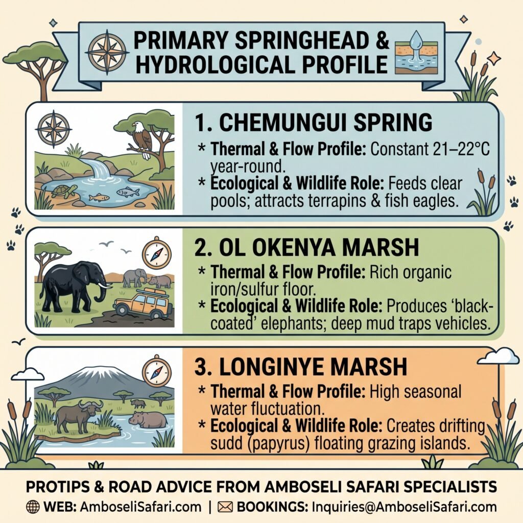
Primary Springhead & Hydrological Profile
The existence of Amboseli’s vast wetland system relies entirely on subterranean volcanic aquifers fed by Mount Kilimanjaro’s snowmelt and rainfall. Underground rock fissures push water upward at key springheads, creating permanent thermal oases across the arid basin floor. The hydrological profile below details the distinct water sources and mud chemistry feeding the primary marshes.
| Springhead / Marsh | Thermal & Flow Profile | Ecological & Wildlife Role |
| Chemungui Spring | Constant 21–22°C year-round | Feeds clear pools; attracts terrapins & fish eagles. |
| Ol Okenya Marsh | Rich organic iron/sulfur floor | Produces “black-coated” elephants; deep mud traps vehicles. |
| Longinye Marsh | High seasonal water fluctuation | Creates drifting sudd (papyrus) floating grazing islands. |
Ol Okenya’s Black Mud
You can tell where an elephant spent its morning by looking at its skin.
Out on the salt flats of Lake Amboseli, herds dust themselves with pale alkaline powder — the “ghost elephants” you see in photographs. Ol Okenya Swamp, just east of Ol Tukai, produces the opposite. The floor there is deep, black, organic mud, centuries of rotted vegetation loaded with iron and sulfur. When an elephant rolls in it and the mud dries, the animal comes out looking oiled. Coal-black. It glints in the sun.
The same mud that paints the elephants will swallow a vehicle. Anthony recalls one April morning after overnight rain when a self-drive Land Cruiser had gone into the soft edge of Ol Okenya, following what looked like a firm track. It took his vehicle, a tow strap, and most of an hour and a half to get it out. The driver had assumed black cotton soil behaves like ordinary mud. It does not. It grips the tyres and does not let go.
Staying at Ol Tukai Lodge Amboseli puts you a few minutes from these feeding grounds — you can be watching black-coated herds emerge from the reeds while other lodges are still on the road in.
Floating Islands and the Simek River
When the rains raise the water level in Longinye Marsh, big root mats of papyrus and cattail tear free from the bottom and drift. Guides call them sudd islands. They move slowly across the deeper channels, and they carry passengers.
Old bull buffalo — the dagga boys — swim out to them to graze on soft new shoots that nothing else has reached. Lions will not cross two meters of open water to follow. So the floating islands become, for a few weeks, the safest grazing in the park.
The Simek River drains the excess out of Enkongo Narok toward the dry lakebed. It is not much of a river in the dry season, but as it slows, salt crystallizes along its banks, and that white crust is where Egyptian geese, Goliath herons, and yellow-necked spurfowl nest. The salt hides their scent from jackals. It is a strange, bare-looking place and one of the better spots in the park for bird watching if you sit still.
Servals, Hippos, and the Marsh Edge
The margin of the swamp is not one thing. Deep in, it is tall papyrus. Then shorter cattail reeds. Then a strip of damp grass before the fever trees start. Each band has its own residents.
The damp grass strip is full of vlei rats and frogs, and that is where you look for servals. Early morning, before the sun is high enough to send them back into cover. Anthony’s advice is to slow right down along the reed line and watch for movement in the grass rather than scanning the open plain — servals are small, and they hunt with their heads down.
Hippos are the opposite problem. They stay in the deep pools all day and come out at dusk to graze, following twin-grooved paths worn into the mud banks over years. Those paths cross the tracks. A hippo does not stop for a vehicle, and a bull moving from water to grass at last light will go straight through anything in its way. The low causeways between Ol Tukai and Observation Hill are the worst for this, and it always happens right when you are pushing to make the 6:00 PM gate. Give the crossings room. The fine for a late exit is cheaper than a hippo through the door.
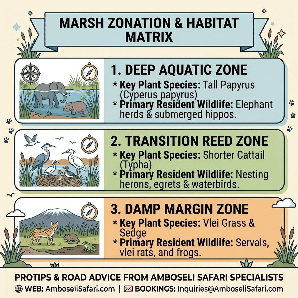
Marsh Zonation & Habitat Matrix
Life within the Amboseli wetlands is strictly organized across concentric botanical belts extending from open water to dry savanna. Each vegetative band provides specific micro-habitats, shelter, and food sources for different predator and prey species. Refer to the zonation matrix below to target specific wildlife encounters along the reed lines.
| Vegetation Zone | Key Plant Species | Primary Resident Wildlife |
| Deep Aquatic | Tall Papyrus (Cyperus papyrus) | Elephant herds & submerged hippos. |
| Transition Reed | Shorter Cattail (Typha) | Nesting herons, egrets & waterbirds. |
| Damp Margin | Vlei Grass & Sedge | Servals, vlei rats, and frogs. |
Driving the Marsh Tracks
The causeways across Ol Okenya have no culverts. After heavy rain on the mountain, groundwater pressure rises and the track floods from below — the water simply comes up through the surface. There is no current, no ripple, nothing to warn you. A still puddle on the track might be ankle-deep or might be a washout.
Anthony’s rule: get out and probe with a stick before you drive through standing water on a marsh causeway. Every time. He has watched too many people trust a puddle.
The section that gives the most trouble is the low crossing on the Ol Tukai to Observation Hill track during the April rains. If it has rained overnight, ask at the lodge or the gate before you commit to it. Our notes on Amboseli road conditions cover the approach from Nairobi; for what to carry inside the park — recovery straps, a shovel, a second spare — read the self-drive tips before you leave.
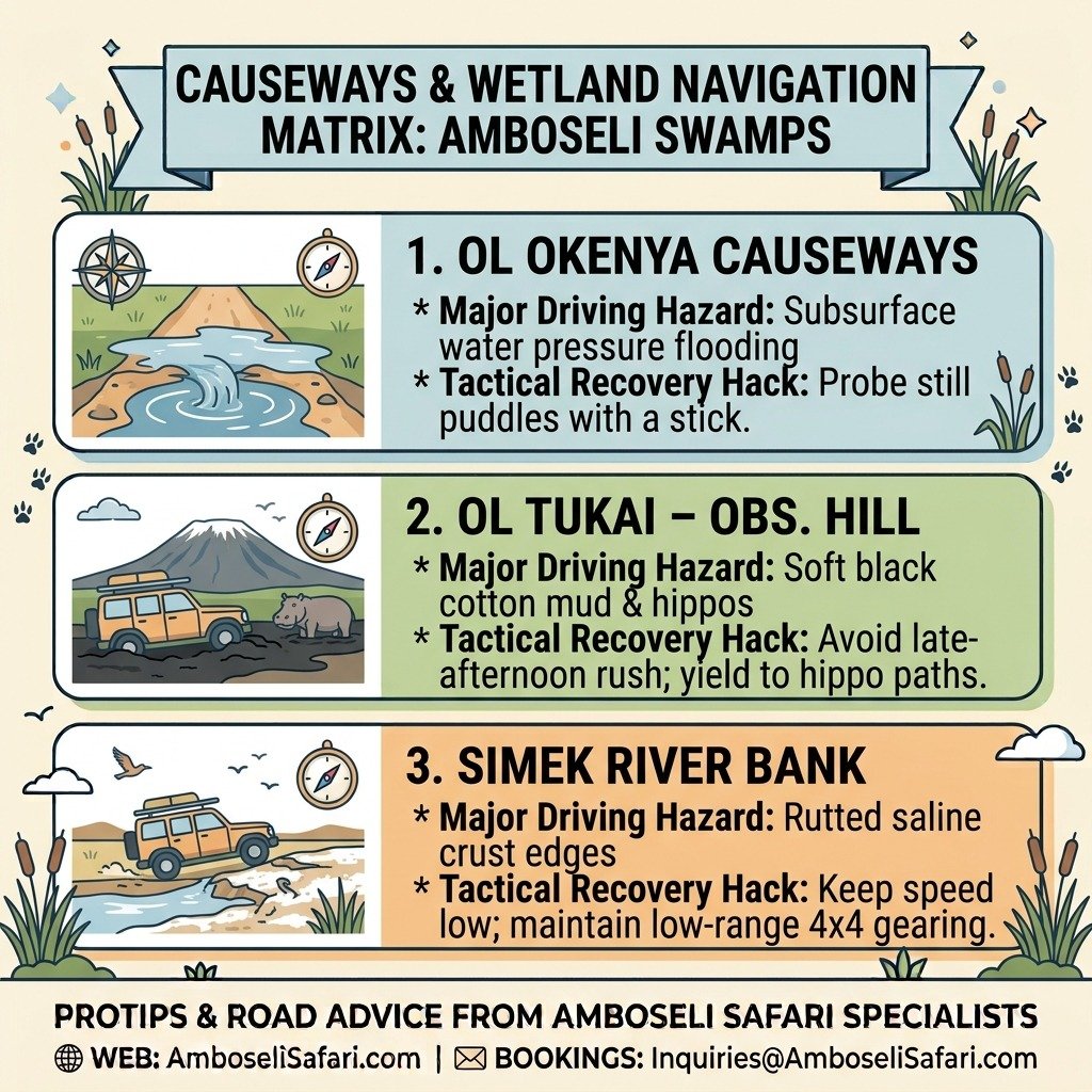
Causeways & Wetland Navigation Matrix
Navigating the dirt causeways crisscrossing Amboseli’s central swamps requires constant vigilance, especially during seasonal groundwater surges. Unseen water pressure can flood low-lying tracks from below without leaving surface currents or warning signs. The tactical navigation matrix below outlines critical hazards and recovery protocols for driving near the marsh edges.
| Route / Crossing | Major Driving Hazard | Tactical Recovery Hack |
| Ol Okenya Causeways | Subsurface water pressure flooding | Probe still puddles with a stick before driving. |
| Ol Tukai – Obs. Hill | Soft black cotton mud & hippos | Avoid late-afternoon rush; yield to hippo paths. |
| Simek River Bank | Rutted saline crust edges | Keep speed low; maintain low-range 4×4 gearing. |
Planning Your Drive
A few practical things, since the marsh circuit is where most people spend their time.
The vehicle matters more here than anywhere else in the park. A high-clearance 4×4 with low-range gearing is not optional in the wet months. In the dry season you can get away with less, but you will still want the ground clearance for the rutted causeways.
Park entry is paid in advance through eCitizen — there is no cash at the gate. Non-resident adults pay USD 90 per 24 hours; the full breakdown of vehicle fees and resident rates is in our entry fees guide. Print your receipt. Phone signal at the gates is unreliable, and the marsh loop is no place to be stuck at 6:00 AM waiting for a PDF to load.
If you would rather not manage any of that, we run guided trips through the marshes on private 4×4 Land Cruisers with a pop-up roof and a driver-guide who knows which causeways flooded last night. Vehicle, fuel, and guide run USD 190 per person sharing per day in normal months and USD 400 in the peak dry season (July to October), when the gates queue and lodges fill. Most guests pair the marshes with a couple of nights in Tsavo West — our 4-day Amboseli and Tsavo West safari starts around USD 1,370 per person sharing at budget lodges in the normal season and runs up to about USD 5,050 for the top-end camps in peak. Park fees, full board, and evacuation cover are included; flights and tips are not.
Send us your dates and we will build the itinerary around when the water is best.
For the research side of the elephant herds you will see in the reeds — the families, the named matriarchs, the long-running study — see our page on the Amboseli Elephant Research Project. For the full picture of what a trip here costs, our safari cost breakdown covers everything from park fees to tipping.
Frequently Asked Questions
Are the swamps in Amboseli permanent?
Yes. Enkongo Narok, Longinye, and Ol Okenya are fed by underground springs from Kilimanjaro. The surface water spreads in the rains and shrinks in the dry months, but the springheads never stop.
Can you do boat safaris or walking safaris in the Amboseli swamps?
No. Boats are not permitted — too many submerged hippos and Nile crocodiles. Walking inside the park is prohibited everywhere except designated sites like Observation Hill.
Why do elephants spend so much time in the swamps?
Food and cooling. When the dry-season grass outside is finished, the papyrus and aquatic grasses are still green. And deep mud cools them, protects the skin from sun, and keeps the insects off.