
Observation Hill Amboseli: Summit Guide & Vantage Tips
Overview
Observation Hill (known locally as Noomotio or Normatior) is an 80-meter (260-foot) volcanic cone in the central sector of the park. It is the only place inside the national park where visitors can leave their safari vehicles and walk around on foot. A staircase built from volcanic basalt rock leads past native fever trees (Acacia xanthophloeia) to two thatched wooden viewing shelters (bandas) at the summit. The hilltop provides open views across the Enkongo Narok swamp, Lake Amboseli, and Mount Kilimanjaro.
Fast Navigation Links
- Summit Hike & Toilet Rules
- Wind Tunnels & Photography Tips
- Swamp Views & Hidden Lakes
- Parking Lot & Maasai Stalls
- Visiting on a Guided Safari
- Frequently Asked Questions
From the open lookout on Observation Hill Amboseli, you can look straight down into the papyrus swamps where elephant herds move through the water, with Mount Kilimanjaro rising behind them.
Known in Maa as Noomotio (and historically as Normatior), this volcanic hill is the main spot in the park where you can safely leave your safari vehicle and walk on foot.
Before heading up the hill, check our Amboseli National Park guide to map out your drive through the surrounding swamp circuits.
The Ascent, Summit Bandas & Base Toilet Logistics
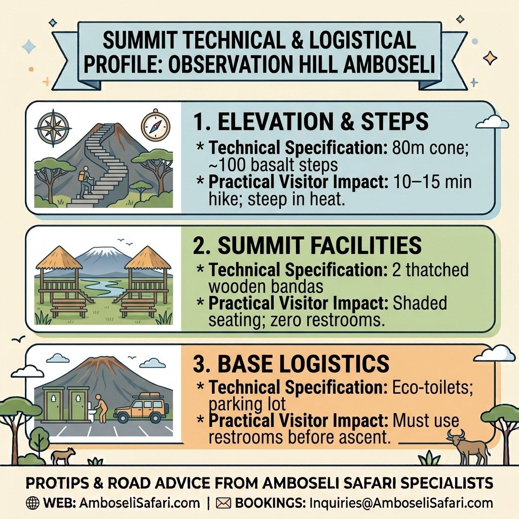
The walk up takes ten to fifteen minutes along a stone staircase carved from native basalt rock. It is a brief hike, though heat and the park’s elevation make it feel a bit steeper.
Summit Viewing Shelters
At the top, two wooden shelters (bandas) with thatched roofs and timber benches offer shade from the midday sun. It is a practical spot to eat a packed breakfast or scan the open plains with binoculars.
Crucial Restroom Logistics
There are zero restrooms at the top of the hill. Make sure to use the basic eco-toilets down at the base parking area before tackling the 100-step basalt staircase.
Thatch-Nesting Birds & Feeding Rules
Superb starlings and white-headed buffalo weavers nest in the thatched roofs of the summit shelters. These birds will fly down to snatch food directly off picnic tables if left unwatched. KWS rangers stationed on the hill actively enforce rules against feeding wildlife, and dropping food can lead to verbal warnings or fines.
Summit Technical & Logistical Profile
Climbing Observation Hill requires a quick physical effort that offers panoramic rewards across the central swamp loops. Knowing the exact physical specifications and site limits helps travelers plan their trek up the volcanic stone steps efficiently. Review the logistical matrix below before leaving your vehicle at the base parking lot.
| Feature / Metric | Technical Specification | Practical Visitor Impact |
| Elevation & Steps | 80m cone; ~100 basalt steps | 10–15 min hike; steep in heat. |
| Summit Facilities | 2 thatched wooden bandas | Shaded seating; zero restrooms. |
| Base Logistics | Eco-toilets; parking lot | Must use restrooms before ascent. |
High-Altitude Photography, Wind Tunnels & Camera Tips
Because the 80-meter hill stands alone on flat plains, wind sweeps across the summit during the day.
Thermal Wind Tunnels
Between 11:30 AM and 3:00 PM, warm air rising off the lakebed creates steady wind gusts across the gazebos. Keep a tight grip on your gear; wind on the summit frequently blows hats and lens caps into the brush below. Photographers using telephoto lenses (300mm or longer) on lightweight tripods will notice camera shake from the wind.
Practical Photography Hacks
- Brace Against Timber: Rest heavy lenses directly against the wooden support posts of the shelters to keep shots steady.
- Secure Small Gear: Keep camera straps around your neck or wrist, and tuck small items like lens caps and cloths securely into a zippered bag.
Check our list of the best camera gear for safari before packing, or read our full Amboseli wildlife photography guide to learn how to handle harsh light over the swamps.
Tactical Summit Photography & Wind Matrix
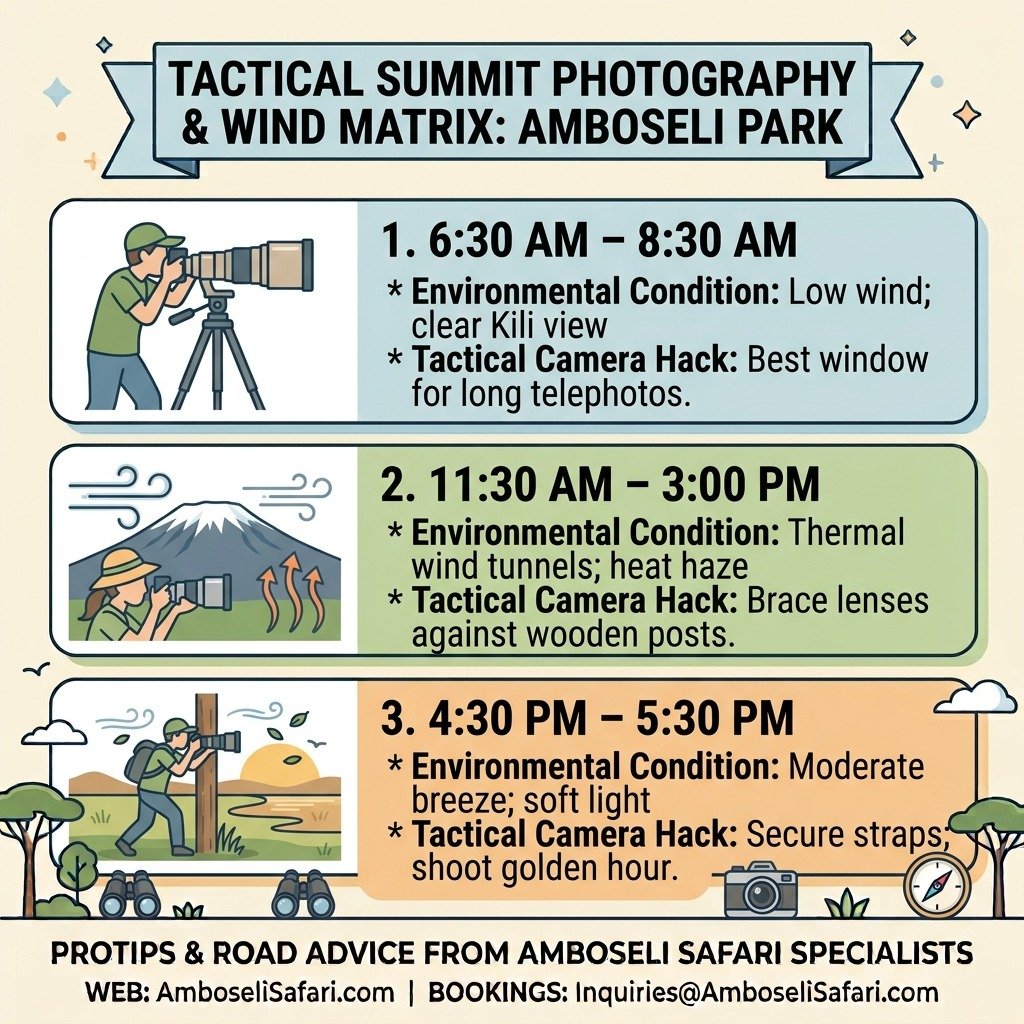
Operating telephoto lenses on top of an exposed 80-meter volcanic mound presents distinct optical challenges throughout the day. Rising thermal air currents create unexpected camera shake and strong gusting wind tunnels across the open viewing decks. Use this tactical photography matrix to time your shoot and secure your gear against the midday breeze.
| Time Window | Environmental Condition | Tactical Camera Hack |
| 6:30 AM–8:30 AM | Low wind; clear Kili view | Best window for long telephotos. |
| 11:30 AM–3:00 PM | Thermal wind tunnels; heat haze | Brace lenses against wooden posts. |
| 4:30 PM–5:30 PM | Moderate breeze; soft light | Secure straps; shoot golden hour. |
What You Can Only See from the Summit: Water Highways & Hidden Lakes
Tall papyrus blocks most views inside the marsh when driving along ground-level tracks. Getting up on the hill changes what you can see.
Aerial Mapping of Elephant “Water Highways”
If you look closely at the green papyrus below in Enkongo Narok swamp, you’ll see pale underwater tracks. Field researchers with the Amboseli Elephant Research Project call these “water highways”—deep mud channels packed down by generations of elephants walking single-file through the marsh.
Uncovering Hidden Lakes & Bird Thickets
Scanning North and Northwest from the summit wooden railing reveals major geographical features that are invisible from ground-level game tracks:
- Kioko Lake: A deep water basin where hippo grunts echo up toward the hill on quiet mornings.
- The Sinet Delta: A thick marsh area to the north that holds large flocks of egrets, herons, and migratory birds.
If you want to track bird species along these northern channels, explore our complete Amboseli bird watching guide.
Exclusive Aerial Sightline & Feature Index
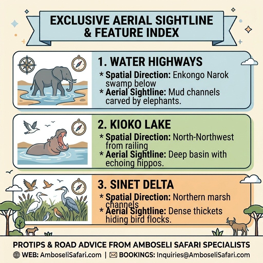
Ground-level safari tracks often obscure hidden water basins behind tall papyrus stalks and dense reed beds. Reaching the summit railing grants a bird’s-eye vantage point over critical hydrological channels and birding hotspots across the park. The sightline index below maps out key geographic features visible exclusively from the lookout deck.
| Visible Landmark | Spatial Direction | Unique Aerial Sightline |
| Water Highways | Enkongo Narok swamp below | Mud channels carved by elephants. |
| Kioko Lake | North-Northwest from railing | Deep basin with echoing hippos. |
| Sinet Delta | Northern marsh channels | Dense thickets hiding bird flocks. |
Base Parking Lot, Maasai Stalls & Driver Radio Network
The flat parking area at the base acts as a central stop for guides, rangers, and local vendors.
Maasai women from neighboring group ranches—managed under local community agreements toward the Narok County Council boundary—sell handmade beadwork, wood carvings, and shúkà blankets under the trees.
While visitors hike up the hill, driver-guides gather in the shade to swap updates over the radio. Spending ten minutes scanning the open ground from the summit gives you a clear view of animal movement across the park, helping your guide track lion prides resting along the swamp edges or cheetahs moving across the dry lakebed.
If you plan to hire a vehicle and drive yourself, take a look at our Amboseli self-drive tips.
Visiting Observation Hill on a Guided Safari
Since Observation Hill sits right in the middle of the central swamp loops, most travelers visit it during a multi-day safari. Booking an all-inclusive trip covers your 4×4 transport, driver-guide, lodging, and KWS park entry passes ($90 USD per 24 hours for non-resident adults).
On Amboselisafari.com, our private tours are calculated for two adults sharing a private 4×4 Safari Land Cruiser with a pop-up roof. Vehicle and guide logistics cost USD 190 per person sharing per day during normal season and USD 400 per person sharing per day during peak dry season (July to October).
Here is how standard guided package rates break down across seasons:
4-Day Amboseli & Tsavo West Safari Packages
Prices are total per person based on two adults sharing accommodation and a private 4×4 Land Cruiser.
| Season & Tier | Included Lodges | Price Per Person (USD) |
| Normal – Budget | AA Lodge Amboseli & Rhino Valley Lodge | USD 1,370 |
| Normal – Mid-Range | Ol Tukai Lodge & Kilaguni Serena Lodge | USD 1,610 |
| Normal – Luxury | Tortilis Camp & Severin Safari Camp | USD 2,150 |
| Normal – Luxury Plus | Angama Amboseli & Finch Hattons | USD 3,560 |
| Peak – Budget | AA Lodge Amboseli & Rhino Valley Lodge | USD 2,300 |
| Peak – Mid-Range | Ol Tukai Lodge & Kilaguni Serena Lodge | USD 2,600 |
| Peak – Luxury | Tortilis Camp & Severin Safari Camp | USD 3,250 |
| Peak – Luxury Plus | Angama Amboseli & Finch Hattons | USD 5,050 |
You can reserve your private Amboseli safari package today or request a custom itinerary for your preferred dates.
Package Inclusions:
- Private 4×4 Safari Land Cruiser with pop-up roof for game drives.
- Services of a TRA-licensed, English-speaking driver-guide.
- All KWS park conservation fees for Amboseli and Tsavo West.
- Full board accommodation (breakfast, lunch, dinner) at listed properties.
- Unlimited bottled drinking water in the vehicle.
- Emergency medical evacuation insurance cover.
Package Exclusions:
- International flights and Kenyan electronic Travel Authorization (eTA) fees.
- Driver-guide tips, alcoholic drinks, and personal laundry.
- Optional activities such as hot air balloon flights.
Optional Add-Ons:
- Maasai Cultural Village Visit: USD 30 per person.
- Amboseli Hot Air Balloon Safari: USD 450 per person.
- One-Way Flight Upgrade (Wilson Airport to Amboseli Airstrip): USD 540 per person (Includes base airline ticket, rate protection cushion, and operator service fee).
Deciding where to stay in Amboseli often depends on gate access. You can calculate full trip costs on our Amboseli safari cost breakdown or view route maps for Kimana Gate and Meshanani Gate.
Frequently Asked Questions
Is Observation Hill accessible for elderly travelers or wheelchair users?
The climb requires walking up approximately 100 basalt stone steps along an incline. There are no ramps or paved wheelchair paths up to the summit. Travelers with severe mobility challenges can stay in the vehicle at the shaded base parking area, where wildlife can still be seen across the lower plains.
Is it safe to walk around Observation Hill outside the vehicle?
Yes, but only within the designated parking area and marked stone trail. KWS armed rangers are stationed at the base and top of the hill to ensure wild animals do not wander onto the footpaths. Stepping off the marked stone trail into the thick brush is strictly prohibited.
What is the best time of day to climb Observation Hill?
Early morning (6:30 AM to 8:30 AM) is the best time to climb. The air is cool, thermal winds have not built up yet, and Mount Kilimanjaro is usually clear of clouds. Late afternoon (4:30 PM to 5:30 PM) is also excellent for golden-hour photography over the swamps.