
Amboseli National Park Size and Location: Maps, Distances & Transit Guide
Overview
Amboseli National Park covers an official gazetted area of 392 square kilometers (151 square miles or 96,867 acres). Situated in Kajiado County in southern Kenya along the border with Tanzania, the park lies 240 kilometers (150 miles) south of Nairobi. In relative terms, Amboseli is compact—about one-fourth the size of the Maasai Mara, 1/23rd the size of Tsavo West, and roughly the same geographic footprint as the city of Denver, Colorado. Managed by the Kenya Wildlife Service (KWS) beneath Mount Kilimanjaro, the park serves as the watered core of a much larger, unfenced 8,000-square-kilometer ecosystem.
Fast Navigation Links
- Core Size & Relative Scale
- Transit Distance Matrix
- SGR Train, Flights & Driving Routes
- Five Gates & Micro-Locations
- Altitude & Mountain Weather
- Rain Shadows & Underground Water Flows
- Safari Packages & Rates
- Frequently Asked Questions
One morning drive here takes you across the salt flats, through the fever trees, and out to the swamps where the elephants feed — with Kilimanjaro behind all of it, on the days it shows.
Understanding how the park is laid out helps you make sense of the territory. It tells you whether taking the train or booking a short flight makes more sense, which entry gate sits closest to your lodge, and why afternoon heat turns into shivering cold the moment the sun dips behind the mountain.
Core Size, Relative Scale & Ecosystem Dispersal
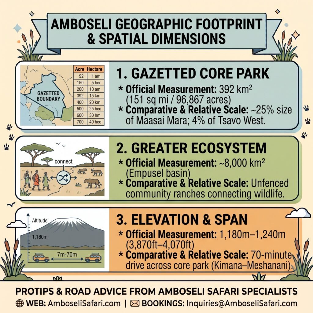
Official markers maintained by the Kenya Wildlife Service set the core park at 392 square kilometers. That is about 151 square miles.
The map shows a boundary. The animals ignore it. When elephant herds march through the swamp toward Kilimanjaro, it becomes obvious that the gazetted park is really just the central drinking hub for a massive, connected ecosystem.
Compared to Kenya’s sprawling wildernesses, Amboseli’s gazetted footprint is tight:
- vs. Maasai Mara (~1,510 km²): Amboseli is roughly one-quarter of the Mara’s size.
- vs. Tsavo West (~9,065 km²): Amboseli is just 4% of Tsavo West.
Outside the official markers, the unfenced dispersal basin—known in Maasai as Empusel—spans nearly 8,000 square kilometers across neighboring community group ranches. Because nine-tenths of the core park consists of dry, open plains surrounding permanent water holes, wildlife concentrates heavily around the central marshes. Driving clear across the park from Kimana Gate in the east to Meshanani Gate in the west takes under 70 minutes at standard safari speeds, giving you an unusually high density of animal sightings per kilometer.
Geographic Footprint & Spatial Dimensions
While Amboseli National Park covers a relatively compact official area, it functions as the watered core of a massive, unfenced cross-border ecosystem. Wildlife moves freely between the central swamps and surrounding community group ranches stretching toward Mount Kilimanjaro. The spatial overview below breaks down the core acreage, elevation range, and relative scale compared to Kenya’s larger reserves.
| Spatial Dimension | Official Measurement | Comparative & Relative Scale |
| Gazetted Core Park | 392 km² (151 sq mi / 96,867 acres) | ~25% size of Maasai Mara; 4% of Tsavo West. |
| Greater Ecosystem | ~8,000 km² (Empusel basin) | Unfenced community ranches connecting wildlife. |
| Elevation & Span | 1,180m–1,240m (3,870ft–4,070ft) | 70-minute drive across core park (Kimana–Meshanani). |
Transit Distance & Drive Time Matrix
Planning your transit requires looking at actual road conditions rather than simple distance numbers on a map:
| Hub / Starting Point | Distance | Average Transit Time | Recommended Route / Option |
| Nairobi (JKIA / City) | 240 km / 150 mi | 4–5 hours | C102 Tarmac via Emali |
| Mombasa (Coast) | 390 km / 242 mi | 7–8 hrs road / 5 hrs SGR | SGR Train to Emali + 1.5 hr transfer |
| Tsavo West (Kilaguni) | 130 km / 80 mi | 2.5–3 hours | C103 gravel via Chyulu Gate |
| Maasai Mara (Sekenani) | 430 km / 267 mi | 8–9 hrs road / 45 min air | Direct bush flight or via Nairobi |
| Namanga (Tanzania Border) | 75 km / 46 mi | 1.5–2 hours | C103 unpaved via Meshanani Gate |
Getting There: SGR Train, Flights & Driving Routes
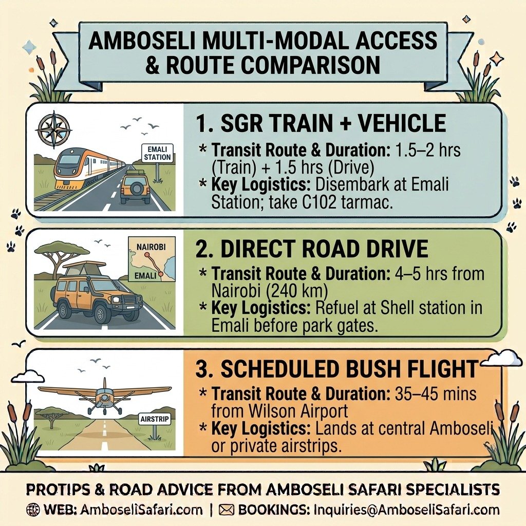
Depending on your budget and timeline, getting to the park boils down to three main travel modes.
1. Madaraka Express SGR Train Access
Riding the Standard Gauge Railway (SGR) is a smooth option whether you are coming from Nairobi or the coast.
- From Nairobi: Board the morning SGR train at Nairobi Terminus in Syokimau and ride to Emali Station in about 1.5 to 2 hours.
- From Mombasa: Catch the train inland to Emali Station, which takes roughly 3.5 to 4 hours.
- Station Transfer: At Emali Station, your safari vehicle meets you for the remaining 90-kilometer drive down the paved C102 tarmac straight to Iremito Gate or Kimana Gate.
2. Flight Access & Landing Airstrips
If you want to bypass long highway drives, daily scheduled bush flights leave Nairobi’s Wilson Airport on regional carriers like Safarilink and AirKenya.
- Flight Duration: Direct flights take 35 to 45 minutes from Nairobi. Coastal flights from Diani (Ukunda) or Mombasa take about an hour.
- Luggage Limits: Light aircraft enforce a strict 15 kg (33 lbs) weight limit per passenger in soft-sided bags.
- Airstrip Options: Most public flights land at the central Amboseli Airstrip inside the park. If you book a stay in surrounding private concessions, you can fly straight to private landing strips like Selenkay or Tortilis, stepping off the plane directly onto quiet concession land without waiting in gate lines.
3. Driving Corridors Compared
When driving down from Nairobi, your choice of route changes the ride dramatically:
- Eastern Route via Emali (C102): Paved tarmac runs all the way to Iremito and Kimana Gates. If you take this route, pull into the Shell station in Emali town to top off fuel, grab cold drinks, and use the clean restrooms before turning onto the C102.
- Western Route via Namanga (A104 to C103): Heads south toward the border before turning east to Meshanani Gate. The final 45 kilometers run over brutal gravel washboard that will shake every loose coin out of your dashboard. A high-clearance 4×4 Land Cruiser is non-negotiable here.
Multi-Modal Access & Route Comparison
Reaching Amboseli National Park from Nairobi or the Kenyan coast can be tailored to fit various travel budgets and timeframes. Whether riding the Madaraka Express SGR train, driving via smooth highway tarmac, or taking a quick flight to a bush airstrip, each transit option carries specific road and luggage logistics. Compare the primary travel routes below to plan your arrival.
| Travel Mode | Transit Route & Duration | Key Logistics & Recommendations |
| SGR Train + Vehicle | 1.5–2 hrs (Train) + 1.5 hrs (Drive) | Disembark at Emali Station; take C102 tarmac. |
| Direct Road Drive | 4–5 hrs from Nairobi (240 km) | Refuel at Shell station in Emali before park gates. |
| Scheduled Bush Flight | 35–45 mins from Wilson Airport | Lands at central Amboseli or private airstrips. |
Five Gates, Micro-Locations & Lodge Strategy
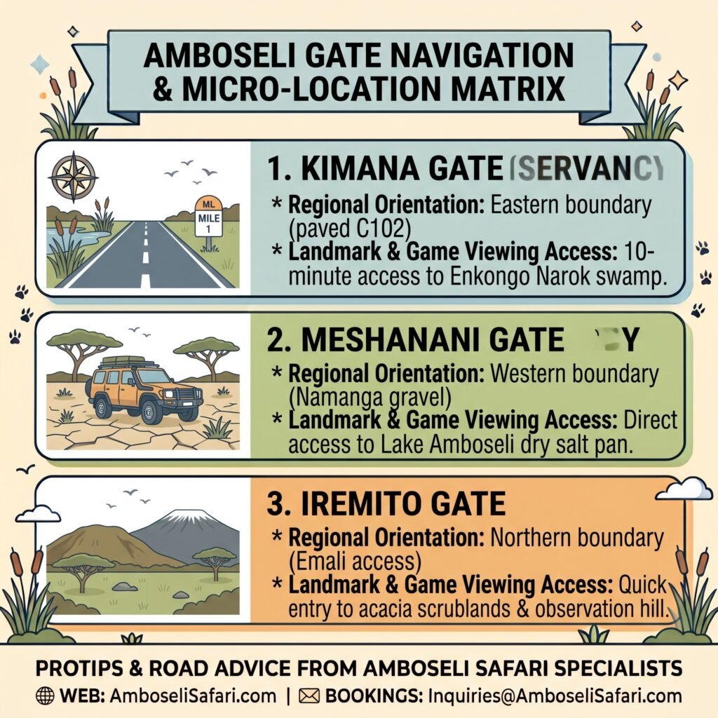
The park boundary is defined by five active entry gates arranged around its perimeter. Iremito Gate anchors the northern border for traffic coming off the Emali tarmac. Kimana Gate sits on the east, putting you right beside the central swamps. Meshanani Gate controls the western entrance for vehicles coming off the rough Namanga gravel track, while Kitirua Gate handles private concessions along the western lake margin. Airstrip Gate sits right in the middle of the park beside the runway.
Key Internal Micro-Locations
- Normatior (Observation Hill): A volcanic ridge that forms the highest lookout in the park, giving you wide views across the wetlands and up toward Kilimanjaro.
- Lake Amboseli Salt Pan: The sprawling, dry seasonal lakebed covering the western half of the reserve.
- Enkongo Narok & Longinye Swamps: The central green oases where elephant herds, hippos, and buffaloes spend the hottest hours of the day.
- Bordering Sanctuaries: Private community reserves—including Selenkay, Kitirua, and Olgulului—that wrap around the park to form a protective buffer.
Where you stay determines your morning drive. Setting up camp near Kimana Gate puts you on the edge of the Enkongo Narok swamp feeding grounds within ten minutes of entering the park. If your lodge sits outside Meshanani Gate, you will spend your first half-hour driving across dry salt flats before reaching the primary wildlife areas.
Gate Navigation & Micro-Location Matrix
Choosing the right entry gate directly influences your morning game drives and overall transit time across the park. Five active gates control entry along the perimeter, each leading directly to distinct micro-climates and wildlife hubs. Review the gate matrix below to pair your accommodation with the most convenient entrance.
| Entry Gate / Location | Regional Orientation | Landmark & Game Viewing Access |
| Kimana Gate | Eastern boundary (paved C102) | 10-minute access to Enkongo Narok swamp. |
| Meshanani Gate | Western boundary (Namanga gravel) | Direct access to Lake Amboseli dry salt pan. |
| Iremito Gate | Northern boundary (Emali access) | Quick entry to acacia scrublands & observation hill. |
Altitude Trough & Mountain Microclimate
As you descend toward the dry lakebed, the dust kicks up and the air warms significantly. The floor drops to 1,180 meters (3,870 feet) above sea level on the dry salt pan, rising slightly to 1,240 meters (4,070 feet) at the summit of Observation Hill.
Sitting in this low basin right beneath Mount Kilimanjaro’s 5,895-meter peak creates a sharp local microclimate. Bring a fleece for evening game drives. Temperatures drop fast from a hot 30°C (86°F) at 4:00 PM to a shivering 14°C (57°F) as soon as the sun dips behind Kilimanjaro.
Rain Shadows and Underground Water Flows
Kilimanjaro’s rainforest slopes catch over 2,000 millimeters of rain each year, but Amboseli sits squarely in its northern rain shadow, receiving less than 350 millimeters of surface rain annually.
Yet despite the dry surface earth, lush green marshes thrive across the center of the park. Volcanic rock layers beneath the soil act as natural plumbing, funneling melted snow and ice underground directly into central swamps like Longinye and Enkongo Narok. This creates a permanent wetland oasis shaded by yellow-fever trees (Acacia xanthophloeia).
Along the southern boundary, the park fence line does not mark the international border with Tanzania. A community buffer within the Olgulului-Ololarashi Group Ranch sits between the fence and the border, allowing elephant herds to move freely into Tanzania’s forest belt without encountering wire barriers.
How to Visit Amboseli: Safari Package Rates & Itineraries
Exploring these spatial zones is straightforward when vehicle logistics, park entry permits ($90 USD per 24 hours for non-resident adults), and lodge bookings are organized into a single private itinerary.
On Amboselisafari.com, our private tours utilize custom 4×4 Safari Land Cruisers with pop-up roofs for open viewing. Daily vehicle rates (including a licensed driver-guide and fuel) run USD 190 per person sharing per day during normal season and USD 400 per person sharing per day during peak dry season (July to October).
We recommend a multi-destination 4-day itinerary pairing Amboseli with Tsavo West.
4-Day Amboseli & Tsavo West Safari Packages
Prices are total per person based on two adults sharing accommodation and a private 4×4 Land Cruiser.
| Season & Tier | Included Lodges | Price Per Person (USD) |
| Normal – Budget | AA Lodge Amboseli & Rhino Valley Lodge | USD 1,370 |
| Normal – Mid-Range | Ol Tukai Lodge & Kilaguni Serena Lodge | USD 1,610 |
| Normal – Luxury | Tortilis Camp & Severin Safari Camp | USD 2,150 |
| Normal – Luxury Plus | Angama Amboseli & Finch Hattons | USD 3,560 |
| Peak – Budget | AA Lodge Amboseli & Rhino Valley Lodge | USD 2,300 |
| Peak – Mid-Range | Ol Tukai Lodge & Kilaguni Serena Lodge | USD 2,600 |
| Peak – Luxury | Tortilis Camp & Severin Safari Camp | USD 3,250 |
| Peak – Luxury Plus | Angama Amboseli & Finch Hattons | USD 5,050 |
Book a Custom Safari Package today to design a private itinerary tailored around your preferred travel dates.
Package Inclusions:
- Private 4×4 Safari Land Cruiser with pop-up roof for game drives.
- Services of a TRA-licensed, English-speaking driver-guide.
- All KWS park entry and vehicle fees for Amboseli and Tsavo West.
- Full board accommodation (breakfast, lunch, dinner) at listed lodges.
- Unlimited bottled drinking water in the vehicle.
- Emergency medical evacuation insurance cover.
Package Exclusions:
- International flights and Kenyan electronic Travel Authorization (eTA) fees.
- Driver-guide tips, alcoholic drinks, and personal laundry.
- Optional activities such as hot air balloon safaris.
Optional Add-Ons:
- Maasai Cultural Village Visit: USD 30 per person.
- Amboseli Hot Air Balloon Safari: USD 450 per person.
- One-Way Flight Upgrade (Wilson Airport to Amboseli Airstrip): USD 540 per person (Includes base flight ticket, landing fees, and bush transfer).
Frequently Asked Questions
How big is Amboseli National Park compared to Maasai Mara or Tsavo?
Amboseli’s gazetted core covers 392 square kilometers (151 sq mi). It is about 25% the size of the Maasai Mara (~1,510 km²) and roughly 1/23rd the size of Tsavo West (~9,065 km²).
Can you take the SGR train to Amboseli National Park?
Yes. You can take the Madaraka Express SGR train from Nairobi or Mombasa to Emali Station. From Emali Station, it is a 90-kilometer (1.5-hour) drive down the paved C102 tarmac road to the park gates.
How long does it take to drive to Amboseli from Nairobi?
Driving from Nairobi via the Emali C102 tarmac route takes roughly 4 to 5 hours (240 km). The western route via Namanga takes about the same time but includes 45 kilometers of rough, unpaved gravel washboard.